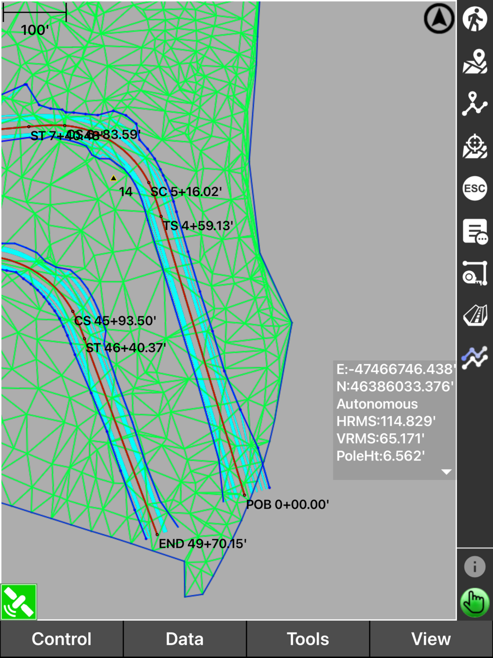
Pocket 3D simplifies digital site management and site surveys for contractors. With full site visibility, crews can access real-time cut-fill data, capture measurements, and quickly generate topo surfaces to boost their productivity.
Site managers and foremen can easily verify earthmoving volumes, grade verification, collect as-built data and track progress to ensure quality control.
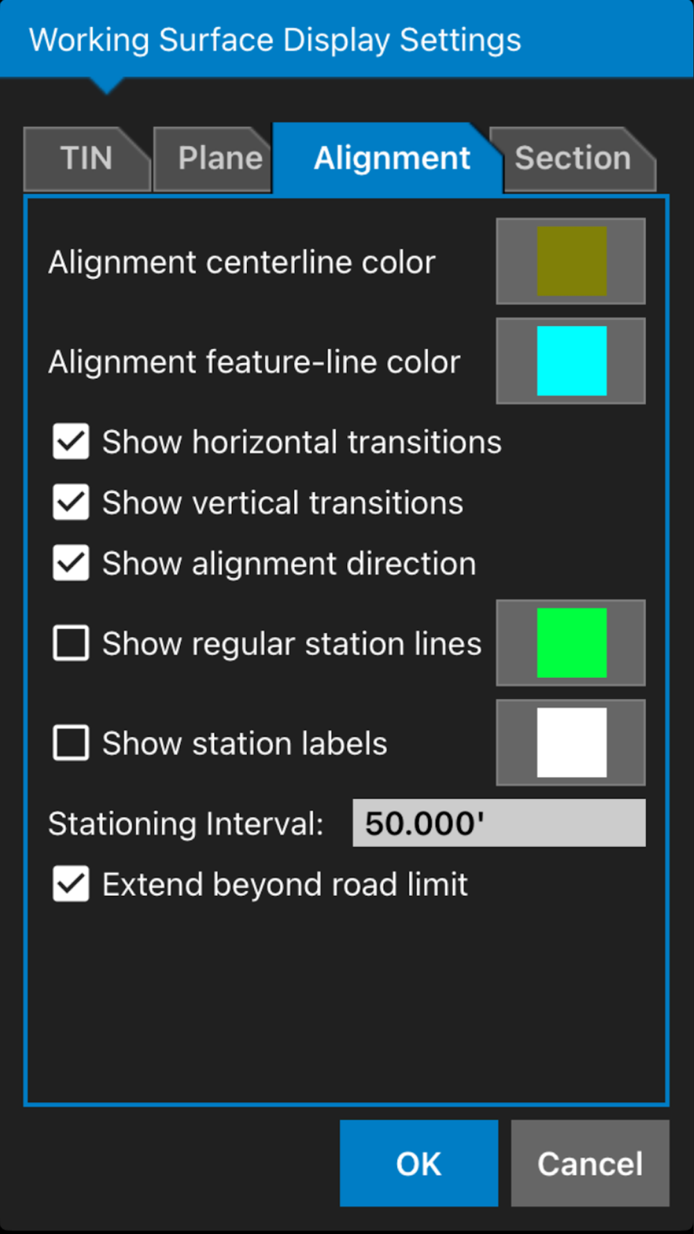
With accessible calculation wizards and in-field design tools, complex tasks can be completed much faster and more efficiently.
Pocket 3D is also Sitelink3D-ready, allowing seamless two-way communication between GNSS rovers and team members. Site plan updates, localizations, and crew management happen instantly, keeping field crews and office leaders connected in real time.