A New Dimension in Terrain Mapping
The TeraTrak™ app, along with the DCI TeraTrak™ R1, gives you the vital terrain data to create your bore plan on-the-fly, so it never becomes obsolete. By simplifying the way site data is collected, the R1 allows anyone on the crew to do surveying specifically designed for the HDD contractor. All the pertinent data your crew needs for the pilot bore is now at their fingertips.
Features at a Glance
• Measure and map precise elevations and distances over your drill path
• Measure terrain distance
• Visualize all the pertinent data on your drill path
• Use in areas where GPS does not work
• Determine rig placement and rod-by-rod entry plan
• Create point-to-point bore plans as you go
• Create rod-by-rod plans from entry to exit
• Export rod-by rod plans in a PDF
• Chart scaling
• Export data for use in bore planners
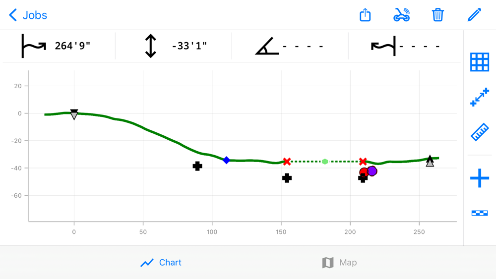
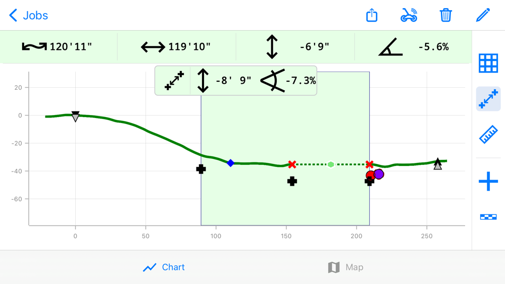
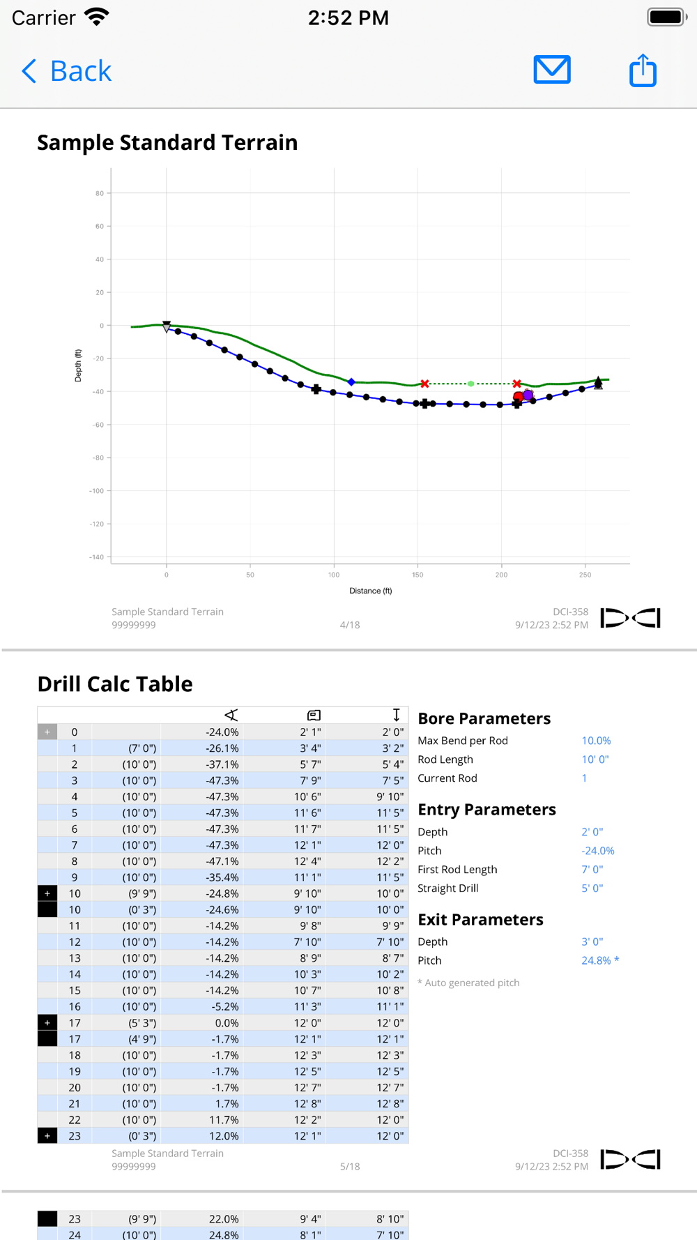
Visualize Your Job Site
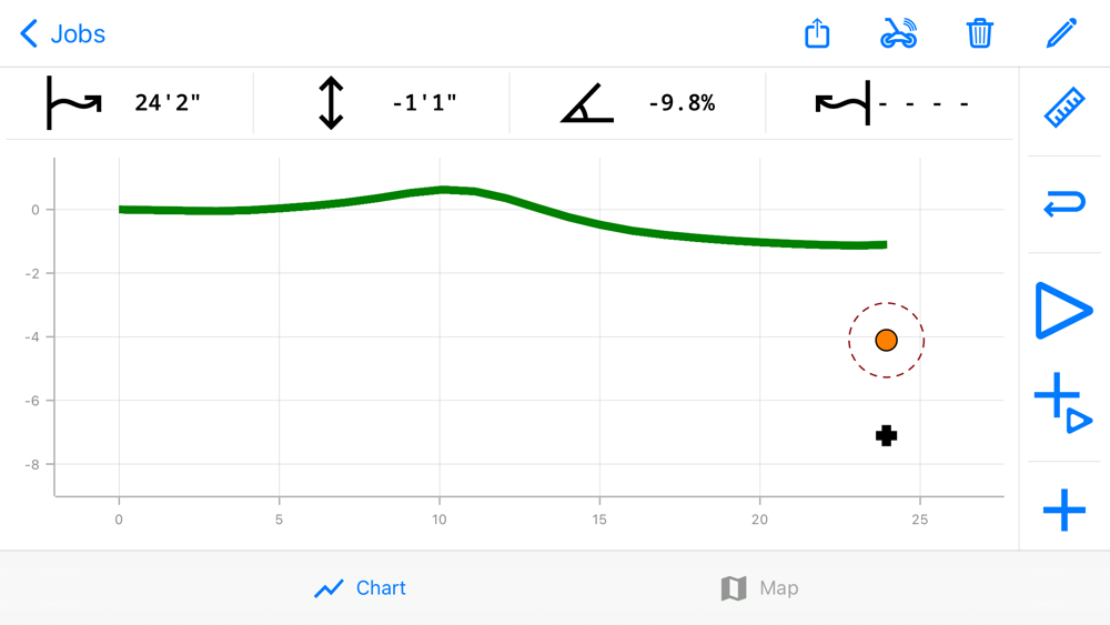
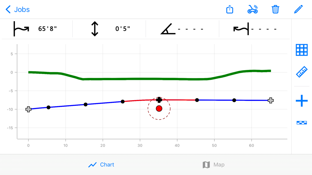
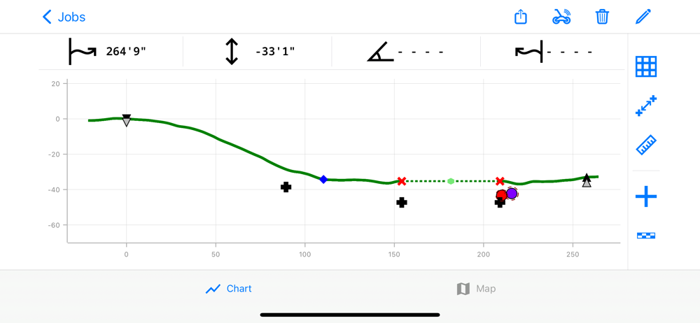
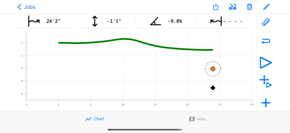
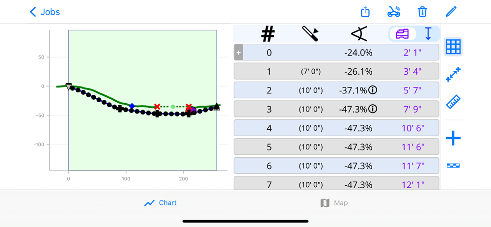
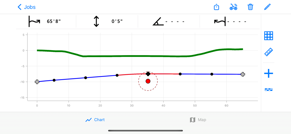
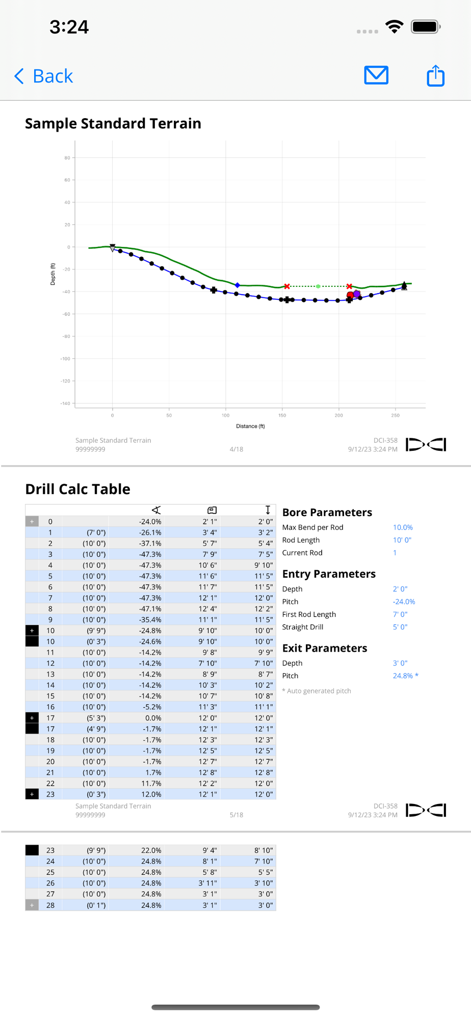
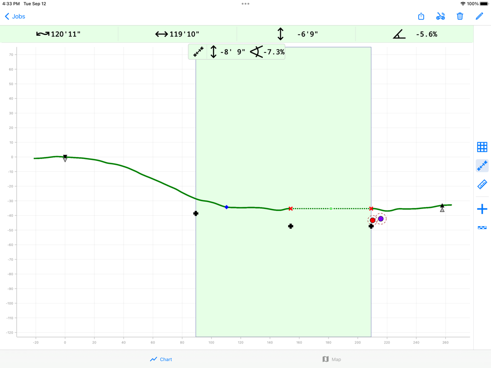
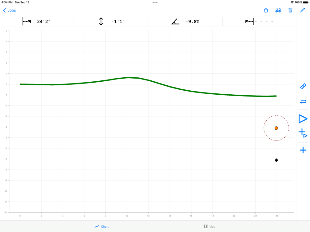
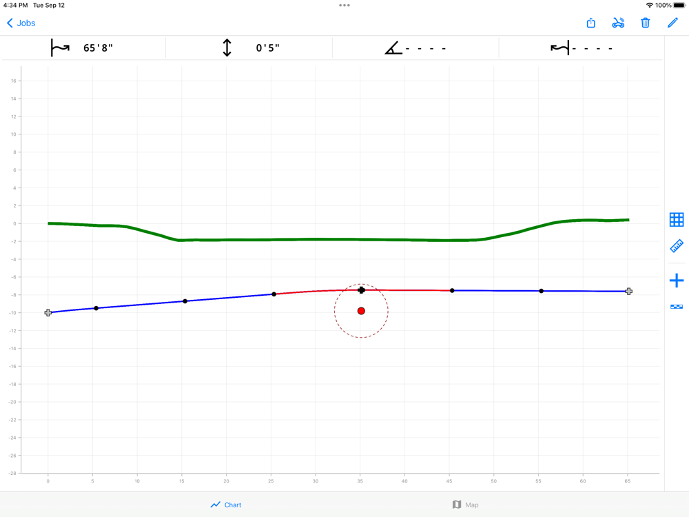
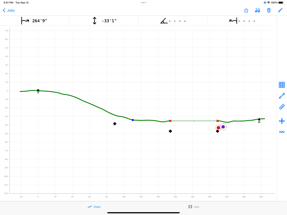
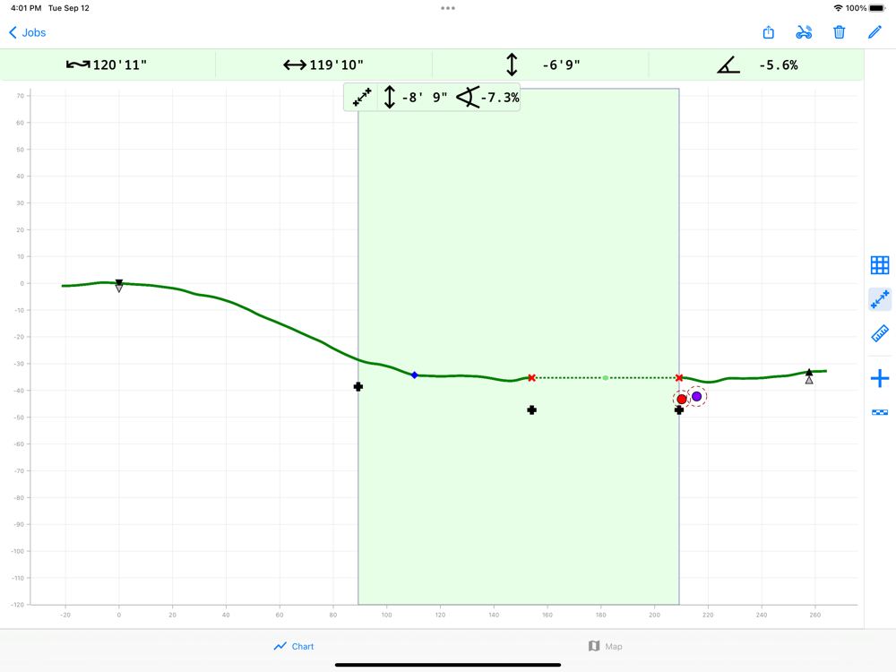
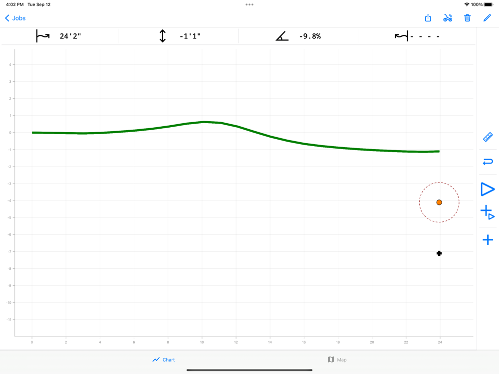
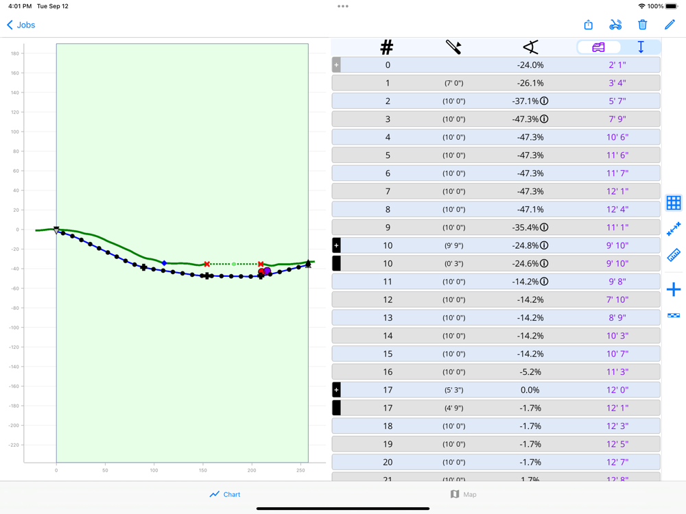
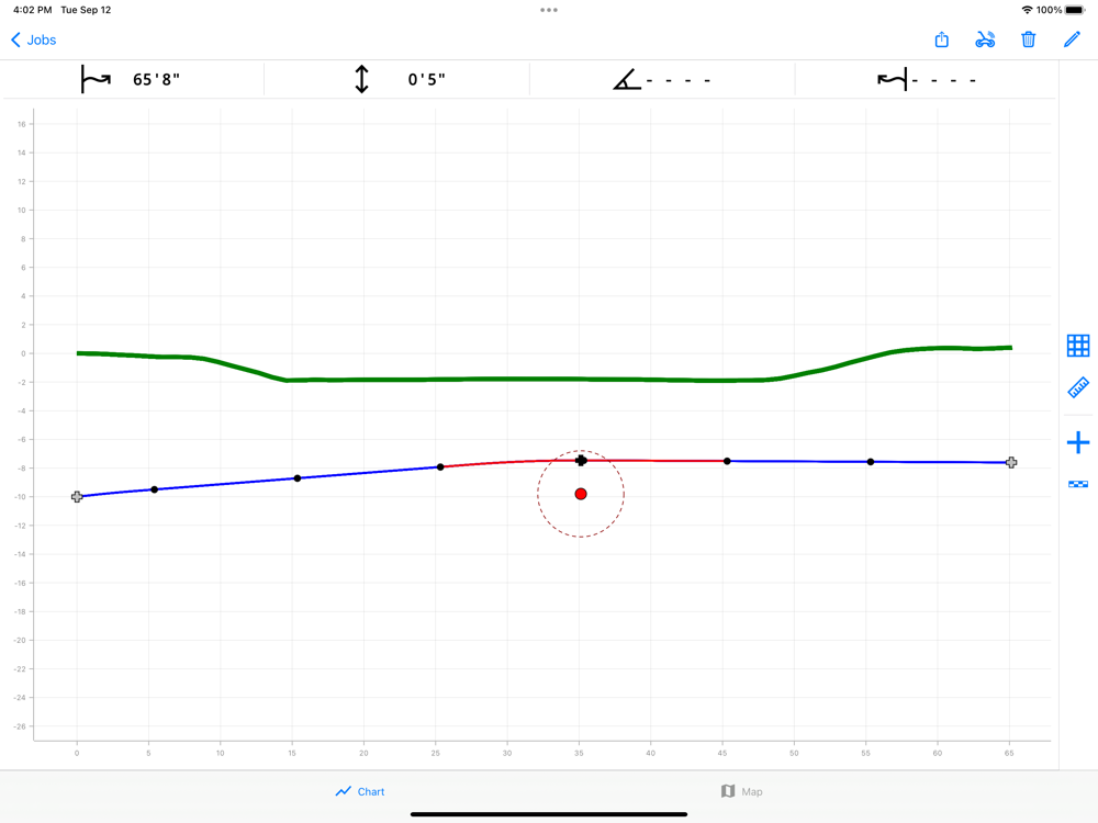
As you walk the DCI TeraTrak™ R1 along the projected bore path, TeraTrak™ builds a terrain map in real-time. You can add entry and exit points, utilities, waypoints, elevations, flags and pins with notes, or other features your crew needs to know about. Easily create and edit your bore plans.
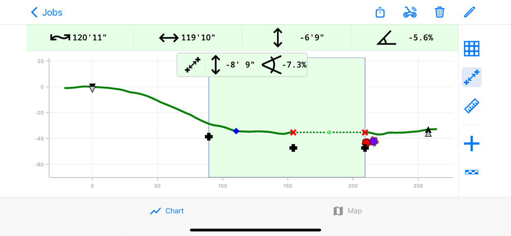
Tap and drag to any point on your mapped terrain to show the precise elevation changes. Easily view both terrain and horizontal distances. For a quick way to view average pitch along the bore, TeraTrak™ will calculate the pitch between two waypoints.
TeraTrak™ gives you more information, faster jobs, quicker decisions, and more confidence in getting it right the first time with fewer redrills.