Hikers Assistant Plus is our next generation solution for hikers. It builds on the code base of Hikers Assistant, eliminates unneeded complexity, adds a significant layer of new functionality, and is streamlined for optimum user efficiency.
No subscriptions and no in-app purchases are required.
KEY FEATURES
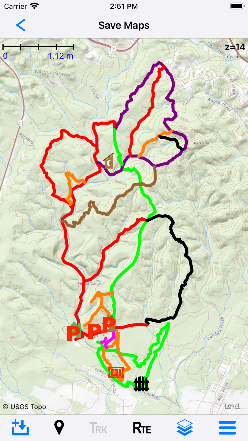
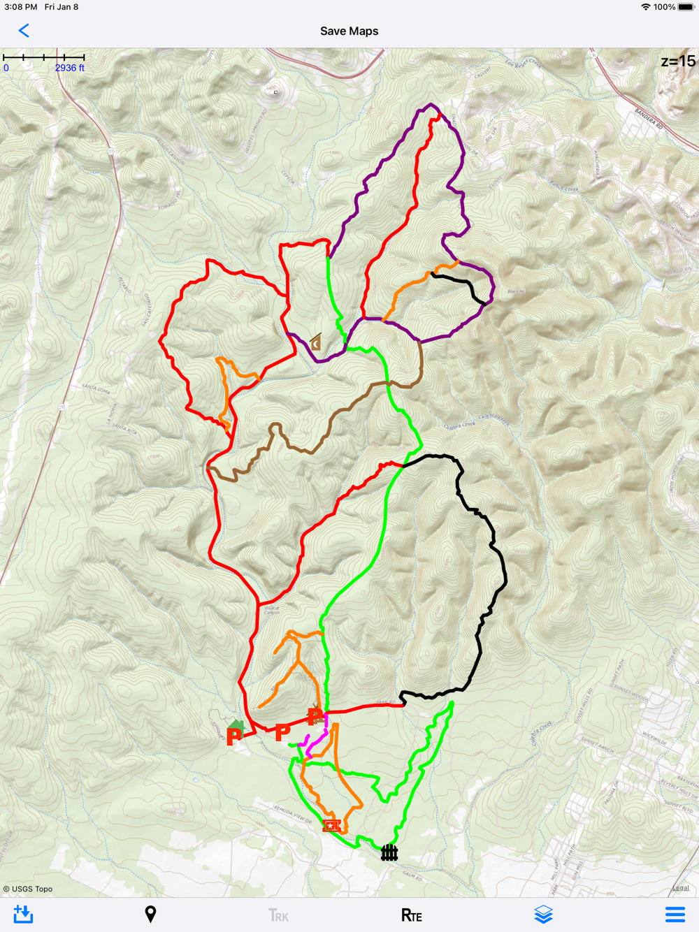
Create routes on maps in Hikers Assist+ (iPad recommended). Import routes via standard GPX files from the Internet. Or collect GPS tracks while on the trail and then convert them to routes for you or your friends.
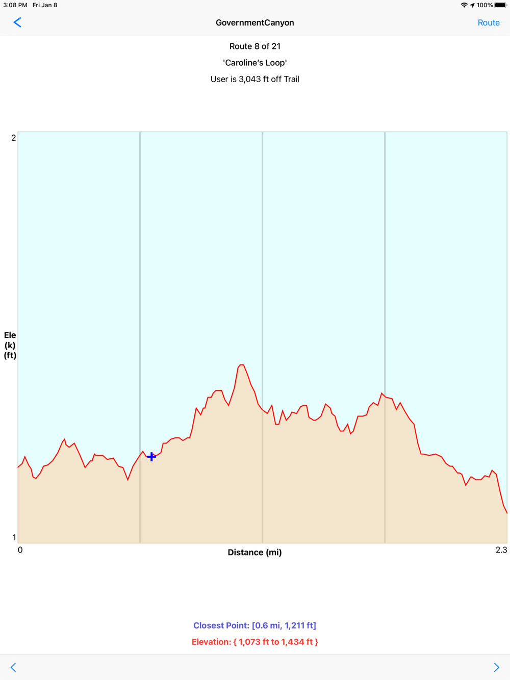
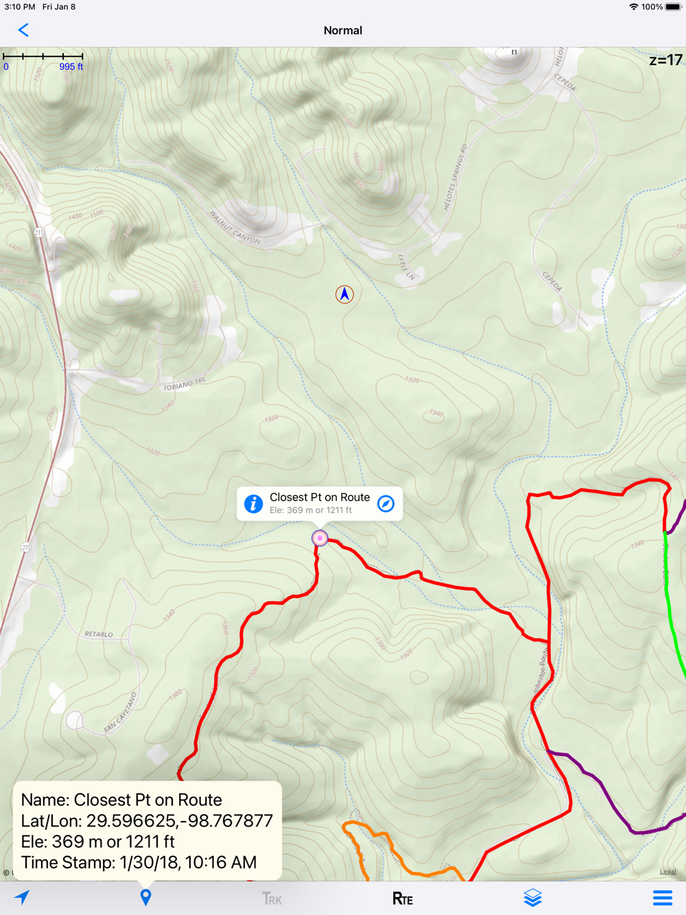
If you’ve loaded tracks, routes, and/or waypoints (we call that trail data), you can get the distance/bearing to the nearest point on the trail at any time or the distance/bearing to any of your waypoints.
If you are confused by intersecting trails, you can put the map into user tracking mode and orient your iPhone along either trail to determine your correct route.
Maps can be downloaded for offline use on trails without cellular access from USGS and other Internet open source map servers. We do not provide our own map servers. Thus all downloaded maps are free of charge.
The app is designed for optimum performance and ease-of-use as a combined phone/watch pair, although the iPhone app alone provides full functionality.
New quick trail (GPS tracking) and quick pedometer modes on both the iPhone and watch let you record tracks and records of your hikes with whatever level of power usage you desire.
Tracks being recorded are instantaneously available on your maps. You will never get lost (even if you get off your trail), and you can always find your way back to the trailhead.
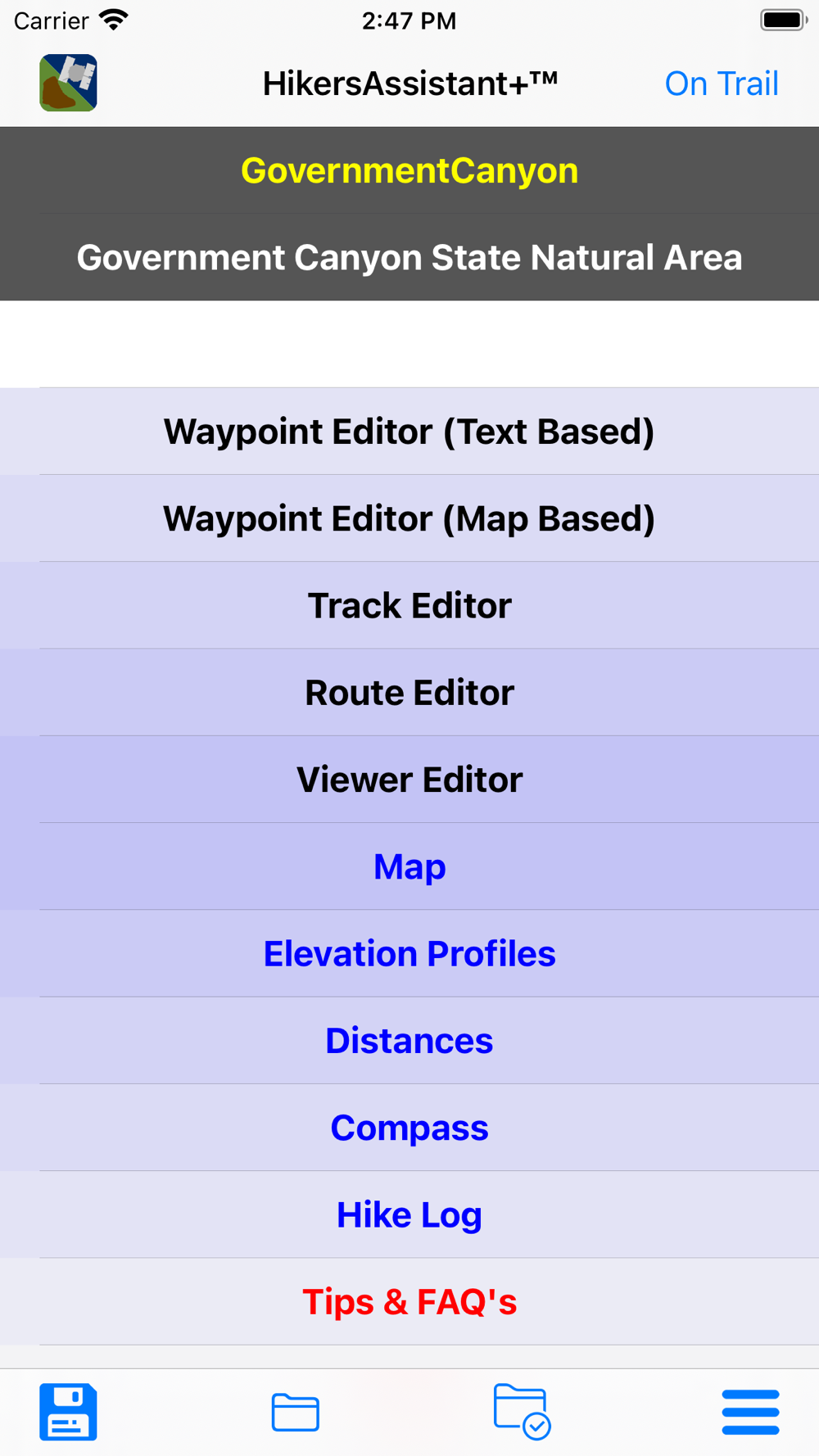
Dual off-trail (route planning and analysis) and on-trail home pages optimize the process of trek planning, creating routes, and safely executing the hike!
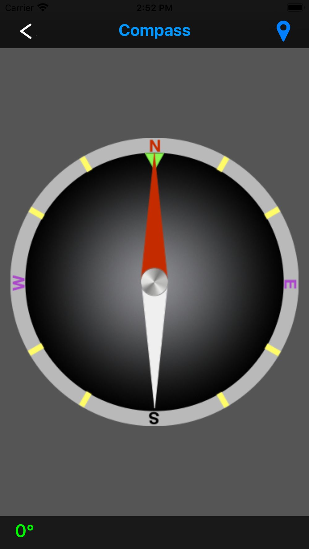
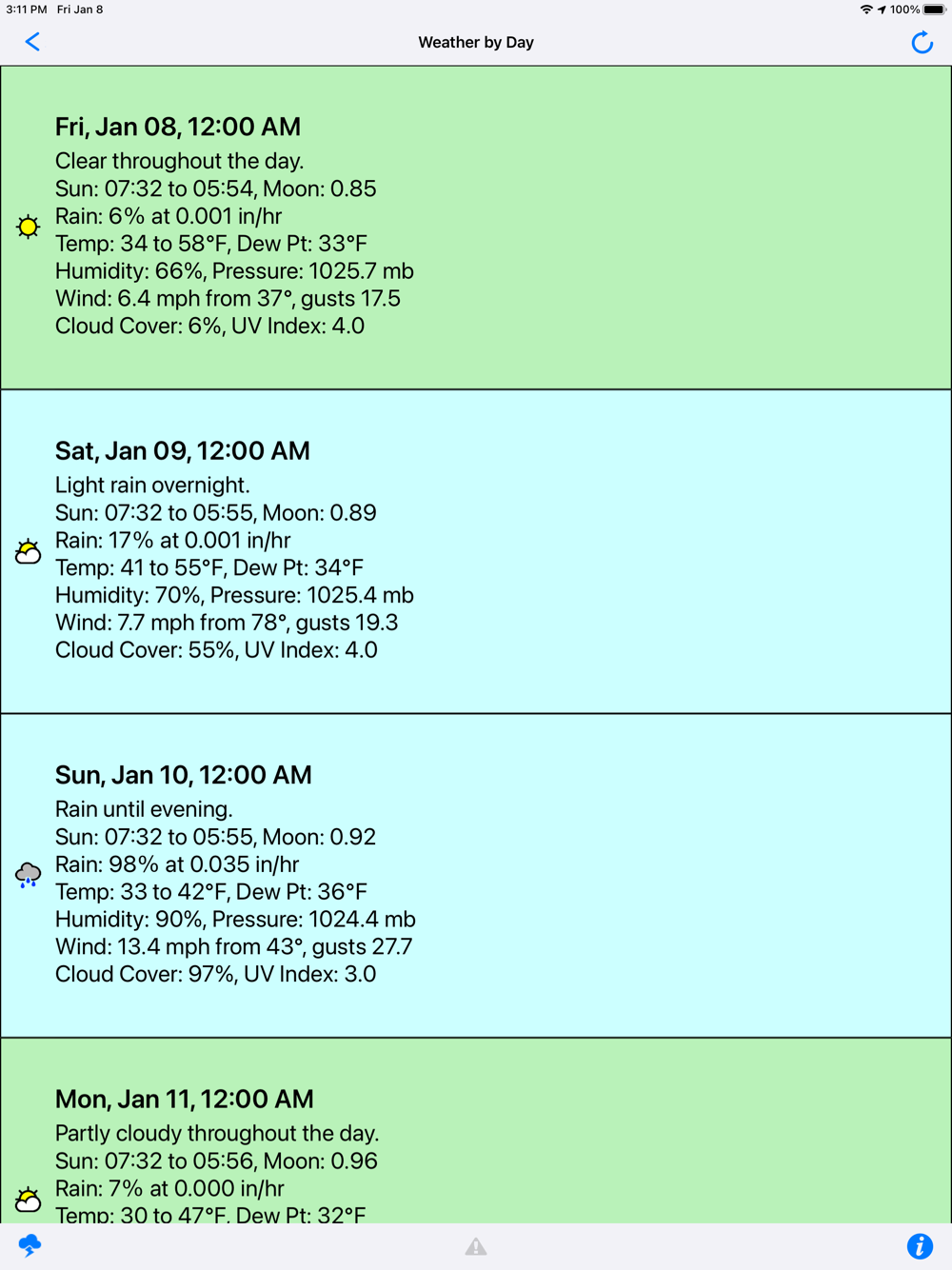
The on-trail home page uses large, easily seen and touched buttons to execute a streamlined set of functionality that includes quickly starting GPS tracking, pedometer logging, showing locations on maps, finding distances and bearings to waypoints, creating new waypoints, using the compass, getting your altitude, sunrise/sunset/moon-phase, downloading weather forecasts, and even viewing images of park maps.
Off-trail, pre-hike planning provides you track, route and waypoint editors, maps where you can create routes, elevation profiles, and an extensive help system. Post trail, you can analyze your performance via hike logs that show time on trail, speed, distance, steps, floors-up/down, calories burned, and battery used.
Trail data (tracks, routes, waypoints) can be saved in binary format both locally on the device or in iCloud. You can import park maps, for on trail viewing, in PNG, JPG or PDF formats. You can share or import GPS trail data in generic/XML based GPX files with nearly any mapping software. If you have trail files from Hikers Assistant, you can simply import those via iOS sharing.
The watch app allows you to monitor your iPhone’s GPS tracking progress, create its own quick GPS trail, log its own quick pedometer-based hike, or just use trail data as needed to find the nearest point on the trail or the distance/bearing to nearby waypoints. In most situations, you can leave your iPhone in your pocket or pack.
The synergy between iPhone and watch apps let you choose the best solution in terms of power usage and convenience to meet all your hiking needs.
OTHER IMPORTANT INFORMATION
For on-trail use, your iOS device needs cellular/GPS capability. Trip planning can be completed on a WiFi-only device, with trail files emailed or transferred via iCloud to your on-trail device.
Offline map downloads rely primarily on USGS servers. Some offline maps support only US regions.
CAUTION: USGS occasionally changes their map server URL's and configurations. This may prevent some offline downloads until the next app update.
Continued use of GPS running in the background can dramatically decrease battery life.