Bristol Maps is designed specifically for commercial fishermen to navigate using the latest satellite imagery. Currently serving Bristol Bay and Copper River watersheds. Say goodbye to outdated maps and inaccurate information - our app utilizes the latest, detailed images for increased efficiency, safer fishing trips, and a higher return on investment.
As a fisherman like you, I've always used NOAA charts for the Bay. Given how fast the environment changes, these are at best, unreliable and at worst, dangerous.
For this I developed Bristol Maps, an app that leverages curated satellite images taken during low tide, displaying the current bar locations, and allows for multiple images to be layered. For areas with multiple images at varying tides, this app allows you to see where there will, or won’t be navigable water. Additionally, these images can be overlayed onto the traditional NOAA charts.
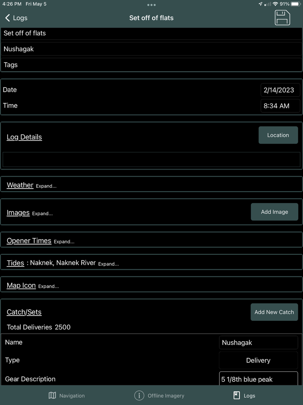
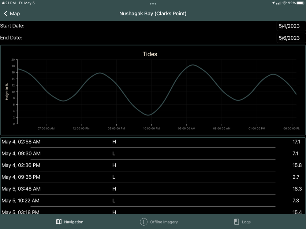
Beyond the core mapping functionality, tide and weather forecasts are also available. Weather can be pinpointed to a location as well as the nearest NOAA zone weather forecast. This information can be combined with the mapping functionality to create digital logs. Location, catch, weather, and tide data can be integrated into a log event. Logs can be overlaid onto the navigation page and analyzed to view catch data by area, gear type (4.75" vs 5"), and weather.
Feature list:
* Satellite overlays available for: Naknek/Kvichak, Egegik, Ugashik, Nushagak, and Copper River. Updated seasonally.
* NOAA overlays available offline for all of Alaska.
* Location grid layouts, organized by color and number, which can replace traditional paper maps or code tables shared by Groups. ie: "I'm over by green 22." A search tool is included to quickly find locations.
* NOAA tide charts available offline for Bristol Bay tide stations. Other locations downloaded as they are used.
* Pinpoint weather forecasts available as well as NOAA zone weather forecasts.
* Boundary lines (with “alarm” functionality), for all major districts are preprogrammed along with the ability to create new boundaries.
* Create Waypoints and Routes. These can also be exported/imported to/from other users to share data.
* Online maps can be streamed with NOAA charts, custom satellite views, a high-res AK Government view, and street view.
* Log entries for recording opener times, district, pictures, sets/deliveries, and automatic tide/weather history.
* Coming this fall, options to have a hard copy 'seasonal' journal.
Bristol Maps has been designed with an intuitive, user friendly interface to solve a common fisherman problem.
Bristol Maps Pricing $150/Year
A two-week free trial is included for testing and includes free cancellation. Subscription includes updates, bug fixes and seasonal imagery additions.