Transform Fieldwork with GeoKit: The Ultimate Geology Mapping & Data Collection App
GeoKit revolutionizes geological fieldwork, offering a complete toolkit for geologists, volcanologists, and mining professionals. Record precise geological features, measure terrain, visualize critical data layers, and export results seamlessly—all offline in remote environments.
Key Features
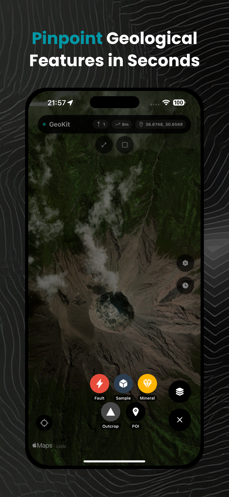
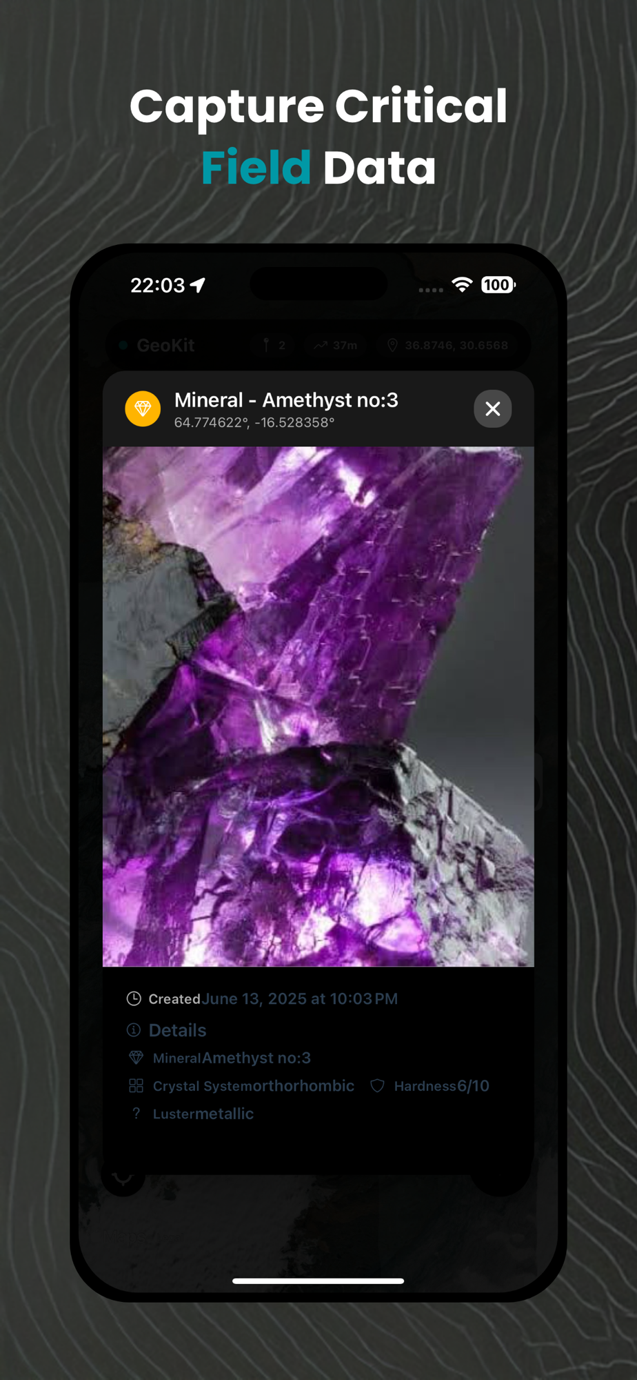
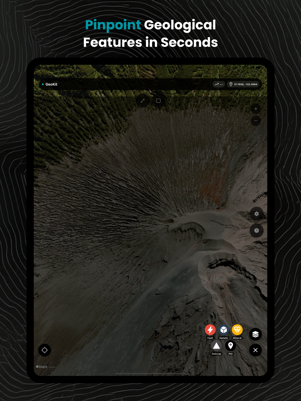
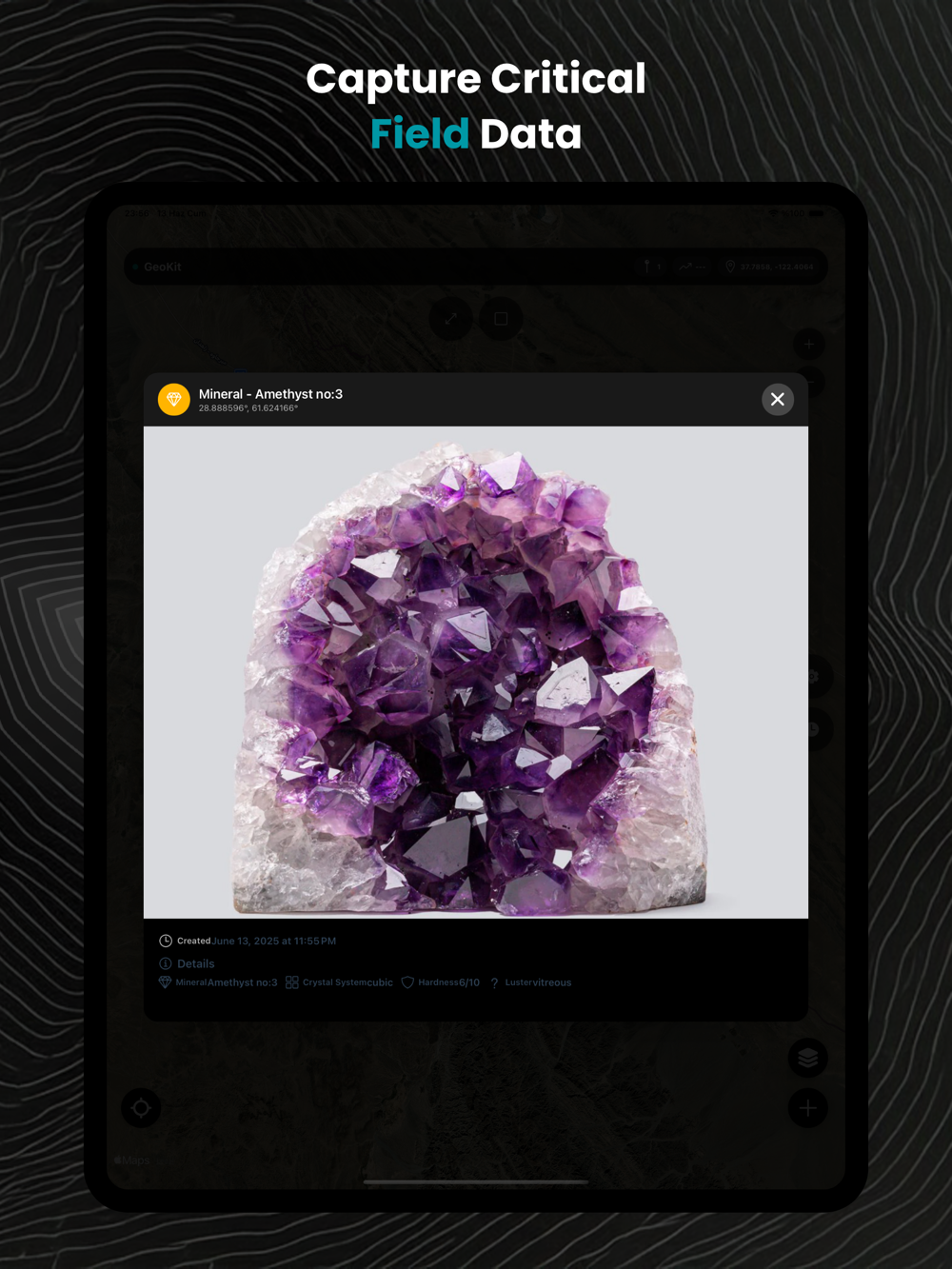
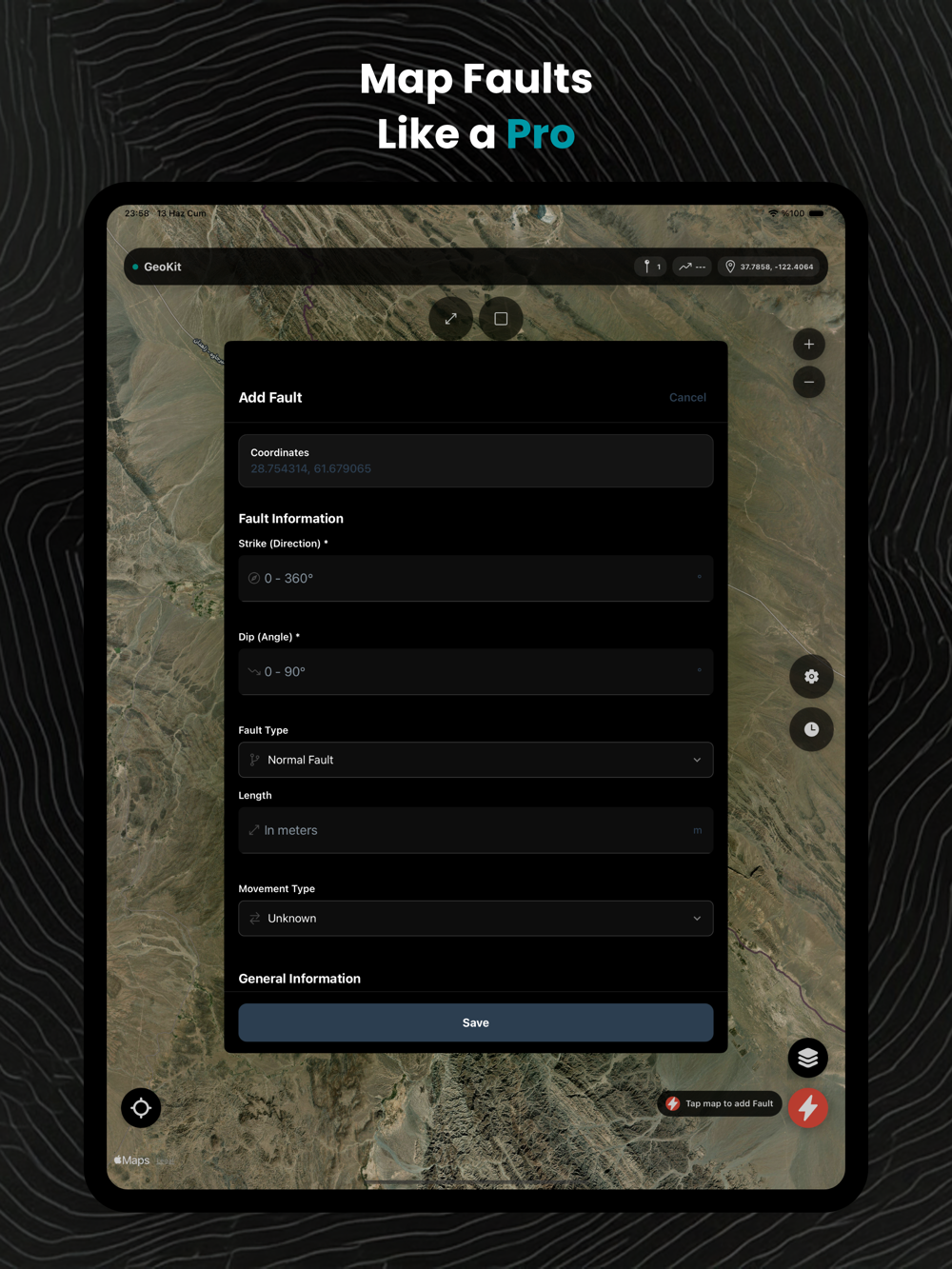
Advanced Geological Markers
Record faults, samples, minerals, outcrops & POIs with custom attributes:
Photo documentation & geotagging
Detailed notes, strike/dip measurements
Mineral composition, rock type classifications
Sample IDs and metadata templates
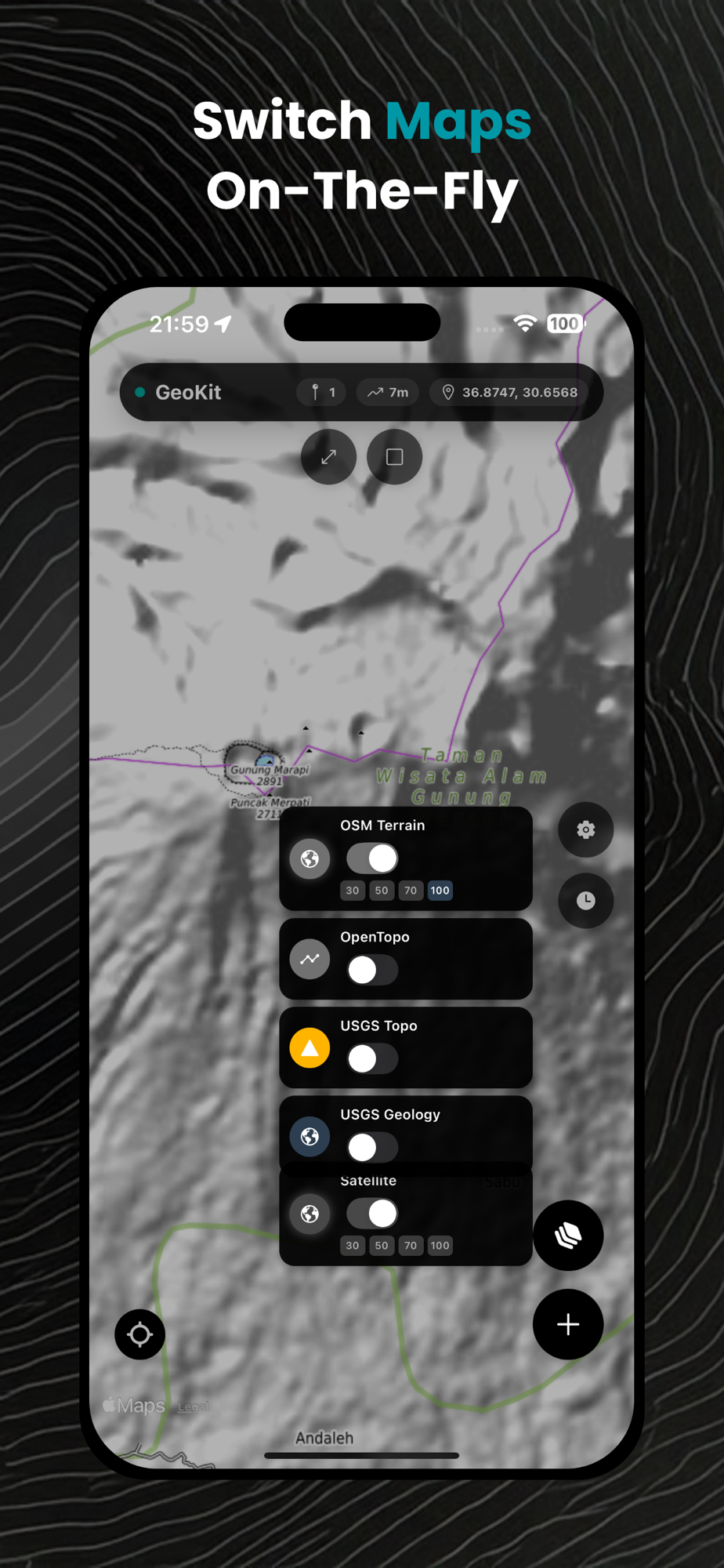
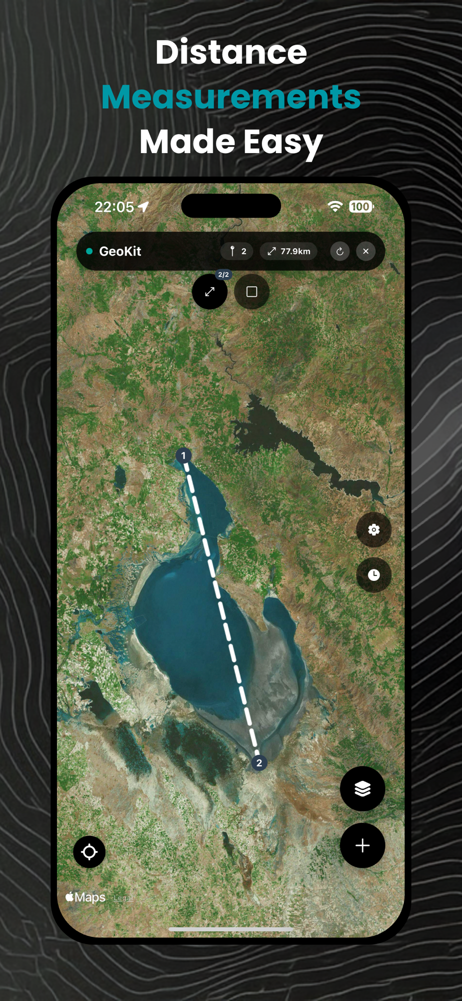
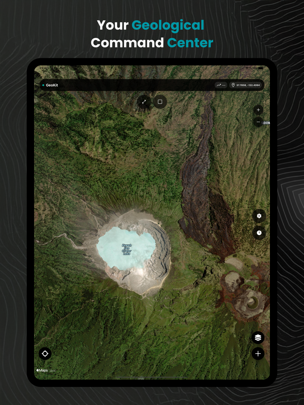
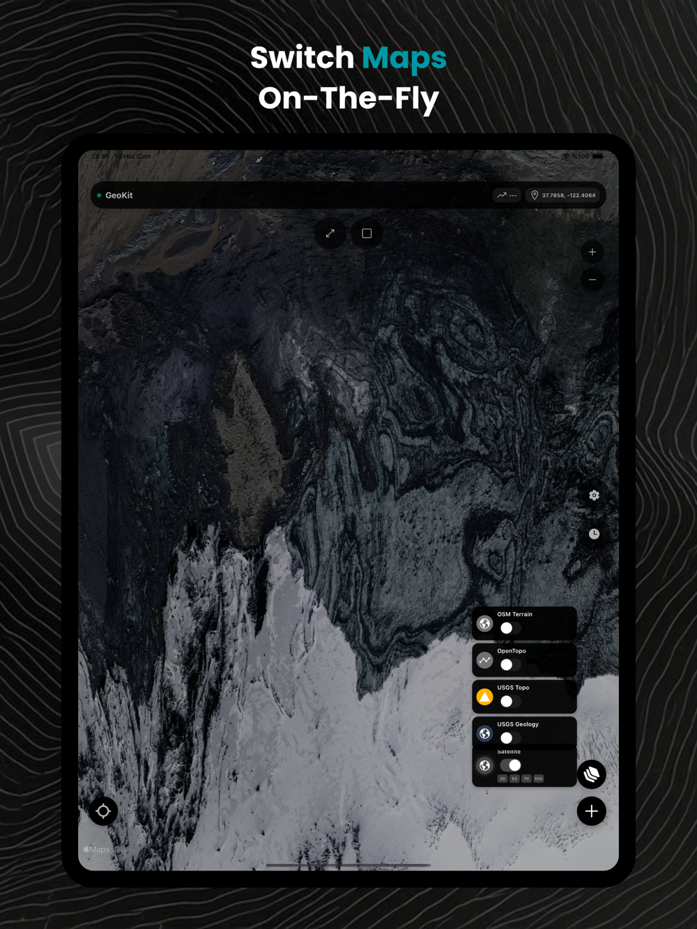
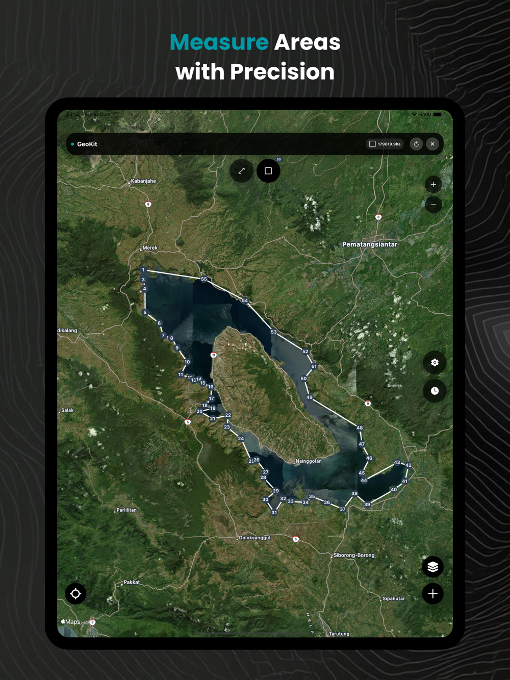
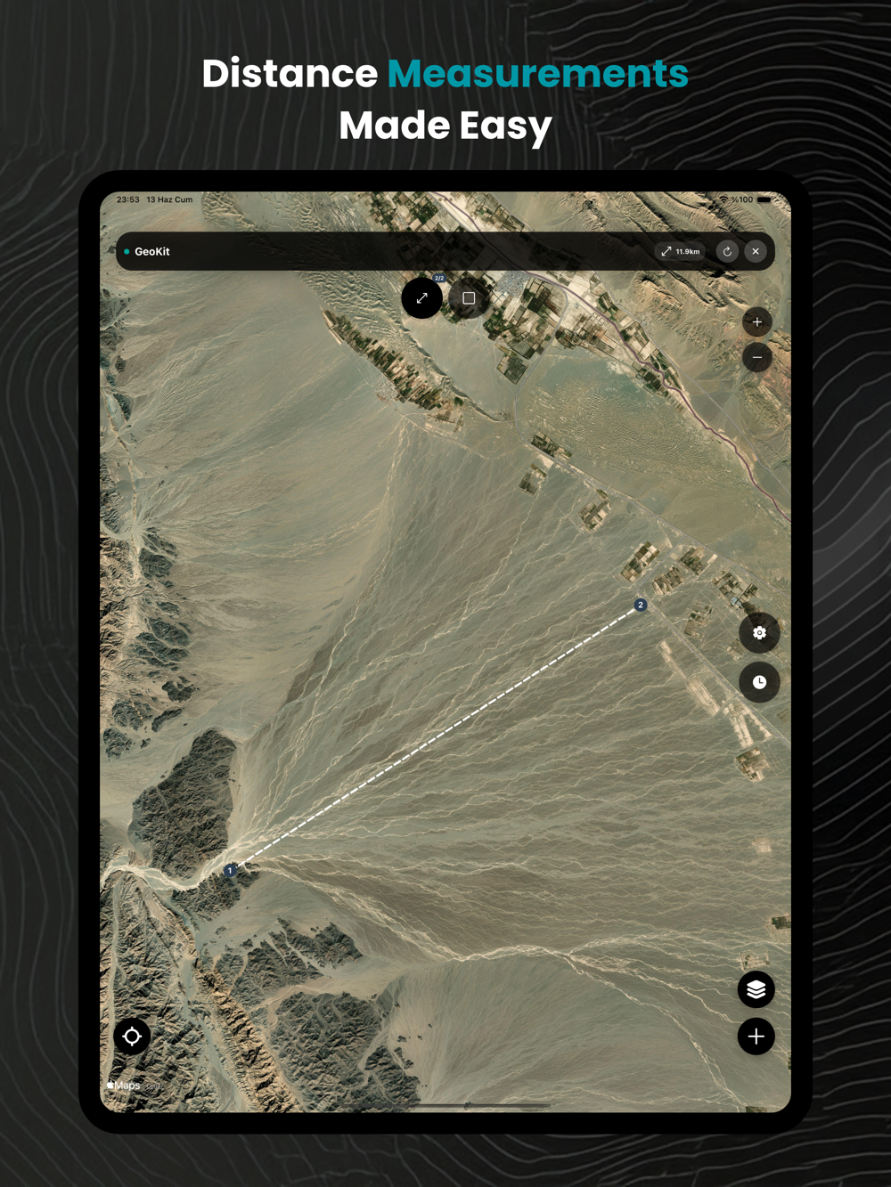
Professional Mapping Tools
Distance & Area Measurement: Accurately plot boundaries, fault lengths, or mineral zones directly on the map.
Multi-Layer Maps: Switch between geological, topographic, and satellite layers (including USGS, OpenTopoMap).
Real-Time Altitude Tracking: Instantly view elevation data for any location.
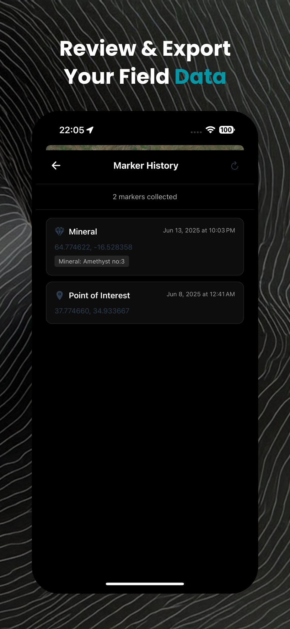
Data Management
Export/Import: Support for GeoJSON, KML, GPX, and CSV formats—integrate with GIS software (QGIS, ArcGIS).
Cloud Sync: Securely backup projects and collaborate across teams.
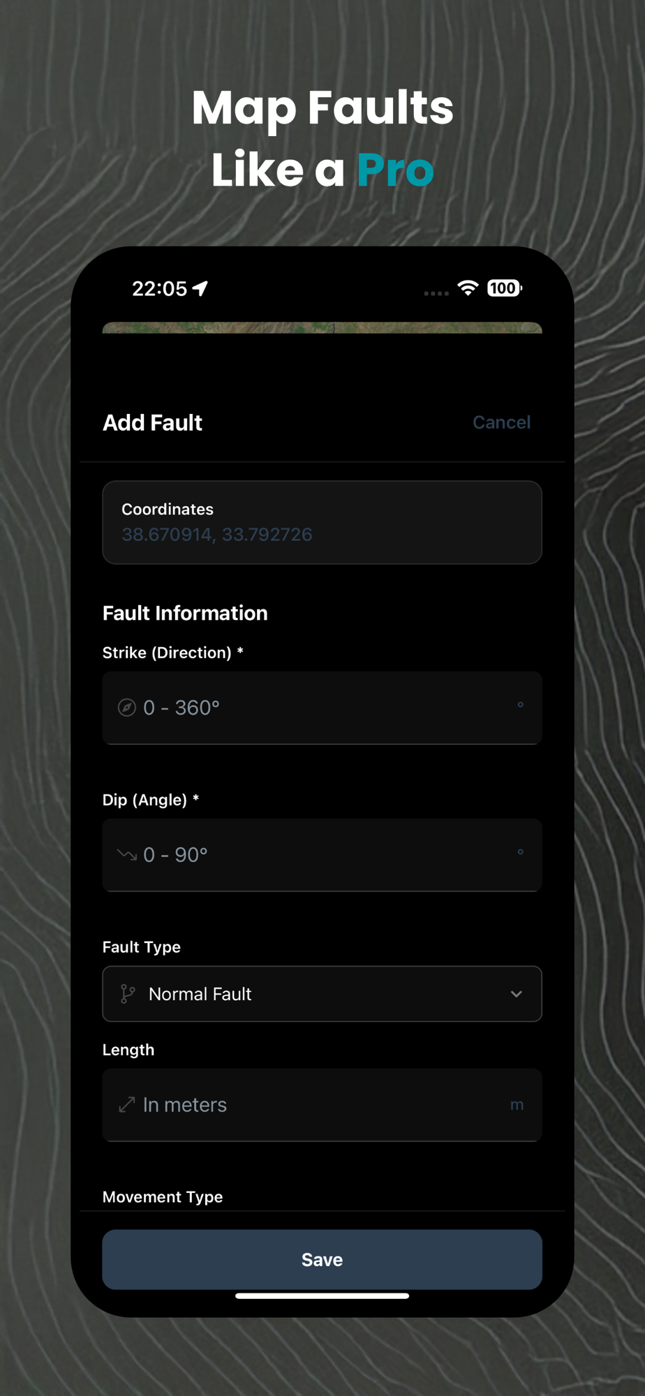
Specialized Geology Tools
Fault Analysis: Log displacement, orientation, and kinematics.
Sample Cataloging: Track locations, weights, and lithology.
Outcrop Mapping: Document stratigraphy and structural features.
Offline Capabilities
Download maps & work without internet—critical for remote mines, volcanoes, or field sites.
Why Professionals Choose GeoKit
Precision: Military-grade GPS accuracy for reliable data collection.
Efficiency: Cut fieldwork time by 50% with intuitive forms and one-tap exports.
Safety: Terrain analysis and hazard zone mapping for volcanic/earthquake-prone areas.
Compliance: Meet industry standards (JORC, NI 43-101) with auditable data trails.
Ideal For Geologists: Mineral exploration, structural mapping, and field surveys.
Volcanologists: Eruption risk assessment and lava flow tracking.
Mining Engineers: Resource estimation and drill site planning.
Academics: Student field trips and research data collection.