eMap HDF is a high-resolution predictive NOAA Doppler storm radar with a weather map.
The weather app has the next layers provided by the National Weather Service (NWS) & NOAA:
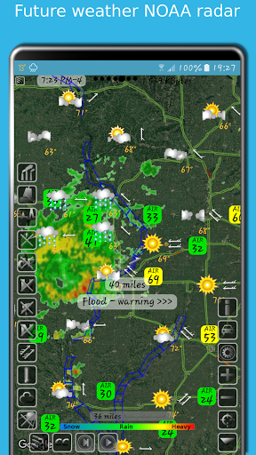
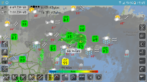
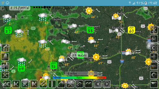
- Snow and rain radar
- Severe weather alerts, tornado tracker, heavy rain and wind alerts
- Lightning strike map
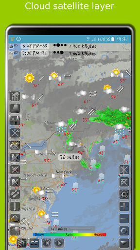
- Cloud satellite layer
Worldwide layers:
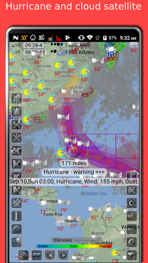
- Typhoon (tropical storm, cyclone) and hurricane tracker provided by GDACS
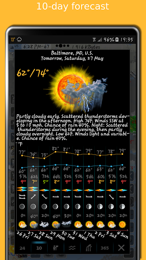
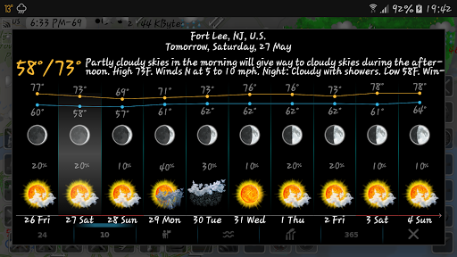
- Accurate weather forecast for 10 days
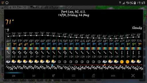
- Hourly weather forecast for 24 hours
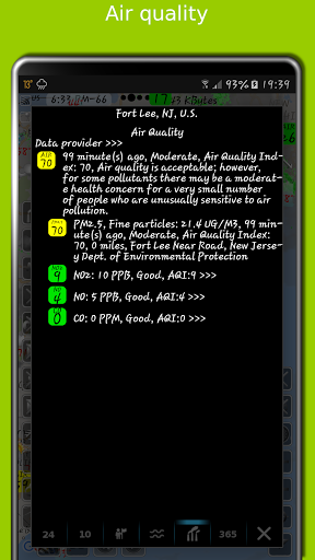
- Air quality and air pollution
- Earthquake map
- Temperature map
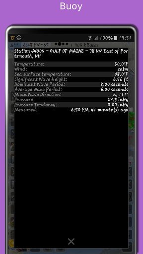
- Sea temperature based on measurements from buoys and satellites
- Tide charts
- Local time in each city
- Number of residents in cities
- Road traffic
- Buoys
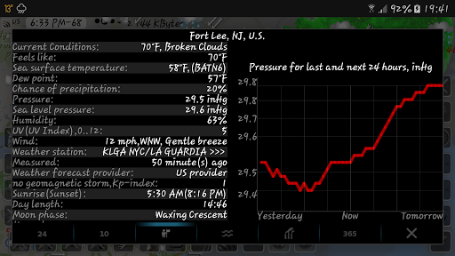
- Dew point
- Humidity
- Wind map
The storm radar app calculates a one-hour prediction of rain and snow in five-minute frames. NOAA radar has a six-hour weather radar history.
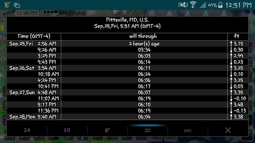
Tide times are for over 10,000 tidal stations in the US, UK, Canada, etc. with forecasts for several months. The app follows the current location and shows the tides near me.
The earthquake app includes earthquakes filtered by magnitude and depth. Earthquake tracker data is provided by the USGS.
The distance measurement tool shows the distance between two points in miles and kilometres.
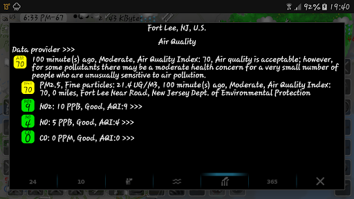
The air quality app includes concentrations of ozone (O3), fine (PM25) and coarse (PM10), particulate matter, dioxide (NO2) and nitrogen oxide (NO), carbon monoxide (CO), etc. from various sources: AirNow, Copernicus, ECMWF, etc.
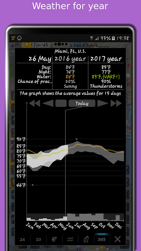
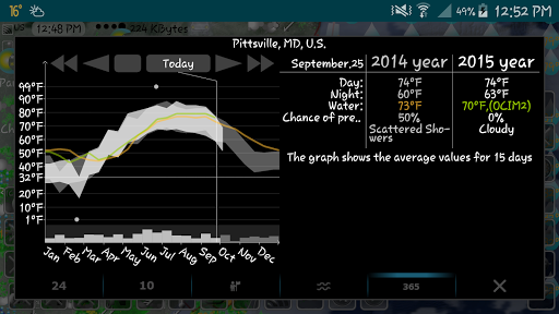
With the Doppler radar app, you can long-click on any location on the map and see the weather at that location with the archive for the last few years. The archive includes sea and air temperature, precipitation and cloud cover. Travel weather helps you choose the right time and place for your upcoming trip and compare temperatures and precipitation between this year and past years.
If you click on the "CC" button and toggle to "10" or "24", you can view a 10-day or 24-hour forecast directly on the map.
eMap HDF shows road traffic. The forecast includes not only temperature and precipitation, but also humidity, wind speed and direction, dew point, visibility on the roads feels like temperature.
As the data published in eMap HDF is not subject to use on the voyage, please do not use it for navigation.